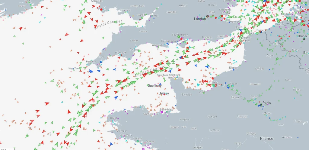

The English Channel and Dover Strait together form one of the most complex, congested, and tightly regulated maritime corridors in the world. Every Officer of the Watch, Chief Officer, and Master must treat this transit with the same seriousness as a pilotage operation. With over 400–500 vessel movements per day, strong tidal streams, high-speed ferries, heavy fishing activity, offshore wind farms, shifting weather, and narrow waterways, this region demands the highest standards of navigation, situational awareness, and bridge teamwork. This expanded guide provides the most detailed, realistic, mariner-oriented A-to-Z resource to help you prepare and execute an inbound or outbound Channel transit with absolute clarity and confidence.
The Geography of the Channel : What Every Mariner Must Visualise
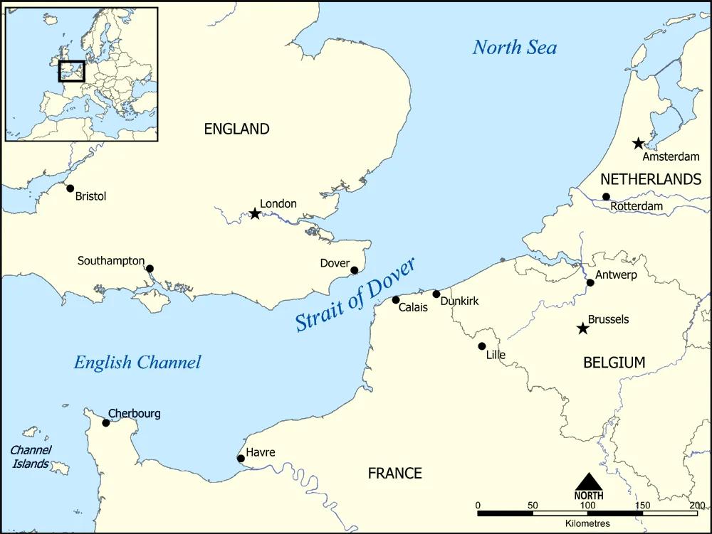
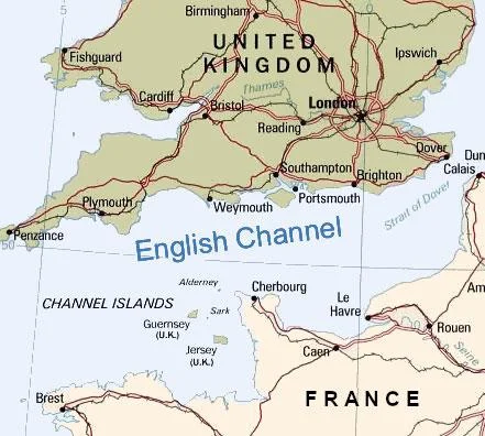
The English Channel stretches between southern England and northern France, gradually narrowing from west to east before squeezing into the famous Dover Strait. Key geographical zones mariners should picture in their mind include the wide western entrance influenced by Atlantic swell, the central Channel with major shipping lanes, and the tight, shallow eastern funnel where hazards such as Goodwin Sands, Varne Bank, Sandettie Bank, and traffic crossing lanes compress navigation. On the English side, landmarks such as Start Point, Portland Bill, St Catherine’s Point, Beachy Head, Dungeness, and the White Cliffs of Dover dominate navigation. On the French side, Cape La Hague, Cherbourg Peninsula, Cap de la Hague and eventually Cap Gris-Nez align the coast. Knowing these features helps maintain mental situational awareness when radar clutter or reduced visibility makes visual navigation difficult.
Why This Area Is So High Risk
Out of all the world’s major shipping routes, the English Channel ranks near the top for navigational difficulty. Risk factors include extremely dense two-way traffic, high-speed ferries between Dover and Calais, a mandatory Traffic Separation Scheme, local fishing fleets deploying nets inside and around the lanes, powerful tidal streams reaching 4–5 knots, shallow banking systems, sudden fog patches, fast-changing weather, and heavy recreational craft activity. The combination of all these elements leaves very little margin for error.
Mandatory Reporting Systems : What Officers Must Know
The Channel Navigation Information Service (CNIS) manages reporting at the Dover Strait, with Gris-Nez Traffic controlling the French side. Depending on vessel type, some ships must submit MAREP/OFFREP reports, while all merchant vessels in the TSS are monitored continuously. AIS is mandatory and must always remain on, transmitting correct voyage details. Ships carrying dangerous cargo must make additional reports at designated positions. Some national authorities may request additional navigational information in case of heavy fog or emergency situations.
Understanding the IMO TSS Structure : Lane Discipline Is Everything
The Dover Strait TSS demands strict compliance with COLREG Rule 10. The northeast-bound lane on the French side is for eastgoing ships entering the North Sea. The southwest-bound lane on the English side is for vessels outbound towards the Atlantic. The central separation zone must not be entered unless avoiding immediate danger. Inshore Traffic Zones are intended primarily for local traffic such as fishing vessels and small craft. Merchant ships above a certain size should not use ITZ except for safety or special circumstances. Keep to the starboard side of your lane, maintain steady course and speed, avoid frequent course alterations, and never stray outside the lane without sound reason.
Tidal Streams : The Invisible Force That Controls Everything
This region has some of the strongest tidal streams in Europe. The direction and strength of the stream completely alter depending on time of high water at Dover. When east-going, the stream can sweep your vessel towards the French coast; when west-going, it can set you towards the English coast. The set may push a vessel across the lane boundary if not corrected early. Around headlands, tidal rips, race conditions, and overfalls appear suddenly. On ECDIS, always display tidal arrows for the area and confirm with Admiralty Tide Tables. A large vessel with deep draft can experience dramatic rate drift if not continuously corrected. Incorrect allowance may place the ship dangerously close to Goodwin Sands.
Major Banks and Hazards : The Places That Sink Ships
Goodwin Sands is one of the most dangerous features in the region, historically known as “The Ship Swallower.” It is a shifting sandbank where many vessels have grounded and broken up. Varne Bank and Sandettie Bank also pose dangers to deep-draft ships, especially during strong tides. The presence of wind farms, underwater cables, wrecks, and pipeline areas add further restrictions. Mariners must highlight these hazards on ECDIS and maintain large safety domains around them.
Fishing Vessels : One of the Biggest Real-World Threats
Fishing activity is intense, especially near the French coast. These vessels: often switch between trawling and steaming, zig-zag unpredictably, may not keep a proper lookout, sometimes display confusing shapes and lights, cross traffic lanes unexpectedly, and deploy gear inside or near the TSS. A large merchant vessel must avoid close-quarters situations with fishing craft well in advance. Radar is essential, but AIS may not always be fitted or may transmit unreliable data.
Cross-Channel Ferries : The Fast, Local, and Unpredictable Players
The ferries between Dover Calais and Dunkirk are among the fastest-moving vessels in the region. They often cross traffic lanes at near right angles and may make sudden heading adjustments to optimize schedule. Many ferries appear bow-on or stern-on on radar, giving small radar echoes. They often alter early but decisively. Mariners should keep generous CPA and expect heavy traffic near ferry terminals.
Meteorology : What Weather Really Looks Like Here
The Channel is exposed to Atlantic wind systems. Common patterns include strong SW winds creating short steep seas in the central channel, sudden sea fog caused by warm air over cold waters, wind-against-tide situations producing rough patches, and poor visibility due to drizzle and haze. When entering Dover Strait, fog banks can suddenly reduce visibility from 10 nm to less than 1 nm within minutes. Radar ranges must be adjusted frequently between 12 nm, 6 nm, 3 nm, and 1.5 nm depending on conditions.
Inbound (West → East) Transit A Realistic Step-by-Step Guide for Mariners
- Join the eastbound lane near Casquets or Ushant with the correct lane discipline.
- Set radar, ARPA, and ECDIS optimally before entering heavy traffic.
- Build a mental traffic picture early don’t wait till vessels are 4–5 nm away.
- Monitor set and drift; adjust early to avoid lane infringement.
- Keep safe distance from the separation zone.
- Watch for fishing gear markers and trap buoys.
- Monitor VHF Channel 11 and 13 as applicable for instructions.
- Approaching Dover Strait, recalculate tide hourly.
- Maintain adequate speed to retain rudder authority against strong currents.
- When visibility reduces, increase vigilance and radar frequency scanning.
- Check CPAs with both ARPA and visual/AIS verification.
- Maintain open communication with Dover Coastguard and Gris-Nez Traffic.
- Stay well clear of cross-Channel ferries at Dover and Calais.
- Once entering the North Sea, ensure transit into the correct North Sea TSS branch.
Outbound (North Sea → Atlantic) Transit Practical Guide - Join the southwest-bound lane correctly from the North Sea approaches.
- Expect congestion around Sandettie and Varne areas.
- Strong east-going or west-going streams can push the vessel across the lane if early correction is not applied.
- Avoid getting too close to Goodwin Sands give at least 2–3 miles margin.
- Monitor ferries approaching from Dunkirk and Calais.
- Maintain a clear passage plan with marked no-go areas.
- Keep bridge team reinforced with extra lookout during night or fog.
- Gradually relax precautions once west of the narrow strait, but keep traffic monitoring high until fully past central Channel congestion.
Pilotage and Local Knowledge Tips Used by Experienced Masters
• Aim to maintain as steady a course as possible while in the lane.
• Prepare a separate section in your passage plan specifically for Dover Strait risks.
• On ECDIS, use a large-scale display (1:50,000 or similar) through the Dover Strait.
• Keep margin from the separation line drift can close this quickly.
• Always track several vessels ahead and astern; the situation changes very fast.
• Use both X-band and S-band radars continuously.
• Avoid unnecessary helm movements to keep predictable for other ships.
• When in doubt, call VTS early; they appreciate proactive ships.
Environment and Compliance
The Channel contains numerous environmental protection zones, ship reporting zones, and restricted areas. Discharge of garbage is strictly prohibited. Ballast water discharge rules apply depending on national regulations. MARPOL violations attract extremely heavy penalties because of the ecological sensitivity of the region.
Bridge Resource Management : This Area Requires Full Team Effort
The Master often stays on the bridge for the entire Dover Strait transit. An enhanced lookout is posted, with the OOW continuously evaluating radar targets, AIS data, tidal set, course stability, and traffic coordination. The engine room should be on short notice if heavy traffic or fog is expected. Clear communication, calm decision-making, and proactive risk assessment make the difference between a safe transit and a hazardous one.
Conclusion
A transit through the English Channel and Dover Strait is a true test of a mariner’s navigation skill, judgement, and bridge management. From strong tides and complex TSS systems to unpredictable ferries, fishing vessels, dense traffic, sudden fog, and hazardous banks, the region demands total professionalism. With strong planning, constant vigilance, correct lane discipline, and coordinated teamwork, a safe and smooth passage is fully achievable for every vessel.