

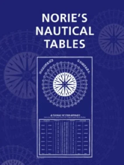
Long before GPS and modern electronic navigation systems, mariners depended entirely on celestial navigation and mathematical tables to determine their position at sea. Among these reference books, Norie’s Nautical Tables have become one of the most important and enduring tools in maritime navigation.
Even today, ships carry Norie’s Tables as part of their mandatory navigational publications, and officers must know how to use them for emergency traditional navigation.
This guide explains everything about Norie’s Tables: what they are, why they are used, how they began, and their importance in both historical and modern navigation.
What Are Norie’s Tables
Norie’s Tables, officially known as Norie’s Nautical Tables, are a comprehensive set of mathematical tables used for celestial navigation, sight reduction, dead reckoning, and solving navigational problems without calculators or electronic devices.
They contain essential navigational data such as:
Logarithms
Trigonometric tables
Sine and cosine values
Meridional parts
Traverse tables
Distance, speed, and time tables
Correction tables
Refraction and dip tables
Azimuth tables
Great circle sailing tables
These tables allow navigators to compute positions using sextant observations and manual calculations.
Why Norie’s Tables Are Used
Norie’s Tables are used for the following purposes:
- Celestial Navigation
To calculate position from sun, moon, planets, and stars using sextant observations. - Sight Reduction
To compute intercepts and azimuths when determining lines of position. - Dead Reckoning
To find distance, speed, and course made good. - Great Circle Navigation
To calculate long ocean passages using the shortest route. - Emergency Navigation
If GPS fails, Norie’s Tables become essential for restoring the ship’s position by traditional means. - Training and Certification
Sextant and table work remain part of maritime exams and competency assessments worldwide.
Even though modern electronics have taken over, Norie’s Tables provide a critical backup and foundation for a navigator’s understanding.
What Norie’s Tables Contain
Norie’s Tables include a wide range of navigational data, such as:
Logarithmic tables
Natural trigonometric tables
Meridional parts
Traverse tables
Distance tables
Time and hour angle tables
Astronomical corrections
Sextant error tables
Dip and refraction corrections
Parallax corrections
Star identification charts
Latitude correction tables
Azimuth and amplitude tables
Right ascension and declination conversions
Together, these tables allow a navigator to perform any traditional navigation calculation without external tools.
Structure of Norie’s Tables
Norie’s Tables are arranged in sections, typically including:
Part 1: Mathematical Tables
Logarithms
Sines and cosines
Tangents and cotangents
Part 2: Navigational Tables
Meridional parts for Mercator sailing
Traverse tables for course and distance
Azimuth tables
Amplitude tables
Part 3: Astronomical Correction Tables
Refraction
Parallax
Dip
Semi-diameter
Altitude corrections
Part 4: Miscellaneous Tables
Distance tables
Conversion tables
Time zone information
Compass corrections
This layout allows quick reference during navigational operations.
How Norie’s Tables Are Used on Board
Marine officers use Norie’s Tables for:
- Sun Sight Reductions
Calculate intercept, bearing, and line of position. - Star and Planet Sights
Determine position using multiple celestial bodies. - Latitude by Meridian Passage
Using maximum altitude of the sun. - Azimuth Calculations
Find compass error and variation. - Great Circle Routing
Using tables for courses and distances. - Mercator Sailing
Using meridional parts from tables. - Course and Distance Conversions
With traverse tables. - Emergency Situations
When GPS and ECDIS fail.
The Origin and History of Norie’s Tables
Norie’s Tables were created by John William Norie (1772–1843), a British mathematician, hydrographer, and teacher of navigation. He was one of the most influential figures in the history of maritime navigation.
The history is as follows:
Early 1800s
Norie was a navigation instructor in London. He found that existing navigational tables were incomplete and not user-friendly.
1810
Norie published the first edition of his Nautical Tables titled “The Complete Epitome of Practical Navigation.”
This book contained mathematical, navigational, and astronomical tables in a simple format that mariners could use easily.
Mid-1800s
The tables became the most widely used navigational reference in the world. Sailors, explorers, traders, and naval forces all relied on them.
Late 19th and 20th centuries
Multiple revisions were made to include improved astronomy, trigonometry, and navigation methods.
Present Day
Norie’s Tables remain in print and continue to be carried on commercial ships as part of mandatory navigational publications. They are also used for training and examinations.
Why Norie’s Tables Became So Popular
Norie’s Tables gained popularity because:
They were more complete than earlier tables
They were easier to understand
They combined all essential tables in a single book
They matched the real needs of navigators at sea
They were regularly updated
They were accepted worldwide
This made Norie’s Tables the standard reference for celestial and mathematical navigation.
Norie’s Tables vs Modern Tools
GPS, ECDIS, and electronic calculators have reduced everyday use of Norie’s Tables.
However, Norie’s Tables are still essential because:
They do not fail during power loss
They do not depend on satellites
They meet the requirements for traditional navigation training
Exams require manual calculation
Marine insurance and safety standards require backup methods
Thus, Norie’s Tables remain an important part of maritime knowledge.
Common Mistakes When Using Norie’s Tables
Misreading logarithmic values
Using wrong page or wrong increment
Forgetting to convert arc to time or vice versa
Using wrong correction for declination
Incorrect interpolation
Mixing degrees and minutes
Incorrect application of dip and refraction
Lack of cross-checking with other methods
Proper training is essential for correct usage.
Importance in Today’s Navigation
Even in the age of modern digital navigation, Norie’s Tables provide:
Skill development
Professional competency
Backup for emergency navigation
Understanding of fundamental principles
Compliance with STCW training standards
Every ship officer must know the basics of table work.
Conclusion
Norie’s Tables are one of the oldest and most important tools in maritime navigation. Created in the early nineteenth century by John William Norie, these tables became the backbone of celestial navigation and remain relevant even today. They provide all the essential data needed to solve navigational problems without electronic assistance.
Understanding Norie’s Tables gives officers confidence, improves navigational skills, and ensures they are prepared for both routine operations and emergencies.