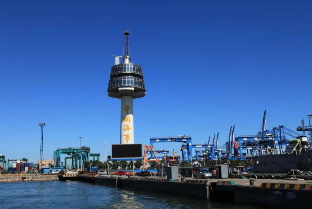

VTS and VTMS are two important systems in modern maritime navigation, with a clear focus on aspects of safety and traffic control. For mariners navigating busy waterways, it is vital that they know how VTS and VTMS operate, the information they provide, the authority they possess, and what is expected from ships. This guide encompasses a thorough, realistic, and practical perspective of VTS and VTMS: history and purpose, functions, categories, communication procedures, equipment, responsibilities of mariners, and real examples.
Vessel Traffic Service (VTS) is a shore-based service which supports navigation, monitors vessel traffic and aims to improve safety and efficiency.
It also contributes to environmental protection in congested or sensitive waterways. VTS works like an “air traffic control” for vessels, guiding them with traffic organization, navigation aid, and provision of information. It enhances situational awareness among mariners through real-time data, monitoring, and coordination of vessel movements.
Vessel Traffic Management System VTMS: The underlying technology and system providing the platform on which a VTS operates.
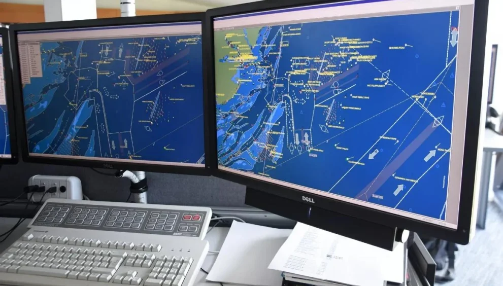
If VTS is the “service,” VTMS is the “equipment, network, and system” that supports it. VTMS integrates radar, AIS, CCTV, VHF, sensors, ECDIS-like systems, and data processing tools to provide a complete picture of the maritime traffic. It puts together all the different data sources so that the operators can keep track of, evaluate, and manage the movements of shipping.
There are several important reasons why VTSs and VTMSs exist.
They help prevent collisions and navigational accidents in congested waters. They organize traffic flow in narrow channels, ports, straits, and river entrances. They help protect the marine environment and sensitive ecological zones. They manage ship movements during poor visibility. They support emergency response and search and rescue operations. They assist vessels through real-time navigational information. They regulate large movements like tankers, LNG carriers, and deep draft ships. They ensure national maritime security and surveillance. These systems reduce risks, improve port efficiency, and increase safe passage for all vessels.
The VTS concept emerged back in the 1960s and 1970s after a number of maritime accidents occurred in some large ports like Rotterdam, Dover, and the Mississippi River.
Along with the increase in ship traffic, a need for monitoring became apparent. Many governments realized the necessity of radar surveillance and coordinated traffic control to avoid major accidents. With encouragement from the IMO’s SOLAS Chapter V, VTS became a uniform system throughout the world. Presently, the majority of major ports and waterways have their respective VTS centers with high-tech equipment.
According to the International Maritime Organization, there exist three main types of VTS:
1.
Information Service (INS): This is the simplest form of VTS. It provides information to ships concerning traffic movements, weather, navigational warnings, tides, and local hazards. Mariners use this in enhancing situational awareness.
2.
NAS-Navigation Assistance Service: this service gives direct assistance to vessels that are in a state of distress due to poor visibility, equipment failure, unfamiliarity, or difficult navigation. VTS may give headings, recommend safe courses, or warn about dangers.
3.
Traffic Organization Service (TOS): This service controls and organizes vessel traffic. Examples of activities included in the TOS are movement schedules, time slots, entry/exit clearances, route assignments, convoy systems, one-way traffic restrictions, and anchorage management. This is again utilized in high-density or restricted areas such as the Dover Strait, Singapore Strait, Houston, and Shanghai.
VTS and VTMS differ in their purpose.
The service that provides communication, regulation, traffic support, and instructions is VTS. VTMS is the integrated system that supports VTS, consisting of radar, AIS, CCTV, GIS charts, sensors, software, a VHF network, controllers, recording systems, and data fusion platforms. In simpler terms, VTS is the operator and authority, whereas VTMS is the system they use.
The centres use a variety of equipment to monitor and manage vessel traffic in VTS and VTMS areas.
These are shore-based radar stations, AIS base stations, high-definition CCTV cameras with night vision and infrared, VHF radiotelephony networks, meteorological sensors, fog sensors, tide gauges, vessel detection sensors, automatic target tracking systems, integrated maritime display systems, large screen monitors displaying real-time traffic, emergency response coordination consoles, and recording and playback systems for investigations. These advanced systems enable VTS to maintain surveillance even in low visibility conditions.
VTS operators continuously track all vessels using radar, AIS data, CCTV validation, and VHF communication.
They pinpoint any potential traffic conflicts, keep track of the closest point of approach and time to closest point of approach between vessels, keep watch on vessels with hazardous cargo, track vessels in shallow water drawing deep drafts, and enforce the rules of navigation.
Mariners sailing within a VTS area are expected to:
– Maintain continual VHF watch on the VTS channel.
– Report at designated mandatory reporting points.
– Obey all traffic instructions and speed limits.
-Update VTS of any changes in position, status, or defects.
– Interact with other ships using proper COLREG rules.
– Use AIS correctly with accurate vessel data.
But it has to be remembered very well that VTS in no way relieves the OOW of his responsibilities.
The OOW remains the main decision-maker on navigation and collision avoidance.
Common VTS instructions and their meanings include:
– “Proceed at slow speed” Reduce speed to safe maneuvering speed.
– “Keep to starboard side of channel” Maintain proper lane discipline.
– “Follow MV XYZ ahead of you” A traffic sequencing instruction.
– “Cross the channel at right angle” A standard COLREG requirement
-“Traffic congested ahead, stand-by to anchor” Expect a delay.
– “Use alternative route” Avoid an accident-prone area or heavy traffic.
– “Report passing buoy number 10” Mandatory reporting position. These instructions help to maintain smooth traffic flow, especially in busy ports. Some of the well-known VTS areas that every mariner must be aware of include: – Dover Strait VTS one of the busiest TSS areas in the world. Singapore Strait VTS Traffic very dense, strong currents. – Rotterdam VTS An advanced VTMS with multi-sector control. HOUSTON VTS – Heavy tanker and pilotage coordination. Hong Kong VTS: Congestion with ferries and cargo ships. Sydney VTS Complex harbor movements. Tokyo Bay VTS Heavy coastal and port traffic. Each VTS region may have different rules, so mariners are required to refer to Admiralty Sailing Directions and port entry guides. VTS provides the following information to vessels: – Traffic conditions and vessel movements. – Hazards, fishing zones, and other local conditions.