ECDIS The Digital Compass of Modern Navigation
There was a time when the bridge smelled of pencil lead and sweat. Shipmen hunkered over paper charts, plotting positions with dividers and parallel rulers. It took time, tolerance, and a sharp mind. Then came ECDIS — Electronic Chart Display and Information System — and everything changed.
We have come a long way from paper charts. But does ECDIS make us better navigators, or just more dependent on screens?
From Paper to Pixels
Paper charts tutored us discipline. You could not afford to miss a fix. Every position had to be plotted with perfection, every correction logged by hand. It was a slower process but it kept your head in the game.
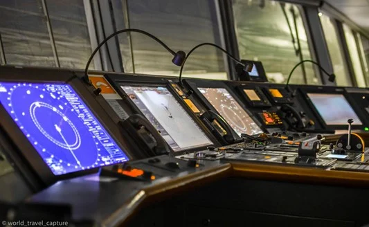
Then came ECDIS, a digital jump. With GPS feeding live positions, ENC( Electronic Navigational Charts) updates, and layers of data like AIS, radar overlays, and route warnings, it made life easier and safer. Plotting became a tap of the screen. Updates came via USB or satellite, not mail.
—
Advantages of ECDIS Over Paper Charts
ECDIS brings a whole new position of efficiency and delicacy to navigation.
Why it beats paper charts
It offers more than just navigation — with real-time data, alerts, and smart features, it gives you an edge that paper charts simply can’t match.
Real- Time Data Display : All nautical information — position, speed, heading, depth, etc. is processed and displayed live, giving the navigator immediate situational mindfulness.
Simplified Passage Planning : ECDIS streamlines passage planning with digital tools that let you produce, edit, and optimize routes with just some limited clicks. It indeed checks for hazards along the route automatically.
Integrated Alarms & cautions: The system includes built- in alarms like cross-track error, shallow water, arrival alarms, and more — helping the OOW stay alert to potential dangers.
Easy Chart Corrections : Gone are the days of pencil corrections on giant charts. ECDIS updates ENCs electronically, saving time and reducing the threat of human error.
System Integration : Other navigational tools like AIS, ARPA, and indeed radar overlays can be synced with ECDIS for a consolidated display.
Flexible Chart View : With zoom- in and zoom- out features, navigators can concentrate on specific areas or get a broader view of the passage, based on the situation.
Accurate ETA Calculations : Because it continuously updates speed and position, ECDIS can give more precise arrival times at waypoints or destinations.
Enhanced Navigational Safety : By combining chart data, alarms, and live inputs, ECDIS significantly improves overall safety — especially in busy or confined waters.
—
But Let’s Not Get Too Comfortable
Here is the thing — ECDIS is only as good as the officer operating it. Over-reliance can be dangerous. It’s easy to turn into a” click navigator” someone who blindly trusts the system without cross-checking. ECDIS can fail. Power issues, software bugs, wrong settings, or outdated charts can lead to disaster.
Numerous grounding incidents in recent times occurred with ECDIS completely functional but inaptly used.
—
Common ECDIS misdoings
1. Zooming in too much
It’s easy to get caught up in the details, but if you zoom in too far on the ECDIS, you might miss the bigger picture — like dangers just outside your screen. Always zoom out once in a while to double-check what’s around you.
2. Skipping ENC updates
When charts aren’t updated regularly, you’re basically sailing blind to any recent changes — like new wrecks, buoys, or restricted areas. Updates might seem routine, but they can save you from a bad day.
3. Sloppy route planning
Drawing routes too close to shallow patches or hazards without proper checks is asking for trouble. It’s not just about plotting — it’s about double-checking, cross-referencing, and thinking ahead.
4. Trusting wrong inputs
ECDIS is only as good as the data it’s fed. If your GPS, gyro, or speed log is acting up, the display might show a position that’s miles off. Always keep an eye on your sensors and trust, but verify
Blind Faith Trusting ECDIS alarms without looking out the window is a big mistake.
—
Checks Before You Trust the Screen
Every watchkeeper must do regular ECDIS checks. Here are some basics
Authenticate the position input source( GPS/ DGPS) is accurate and stable.
Ensure safety contours and depth settings are applicable for the ship’s draft.
Double-check where you are
Don’t just rely on the screen — confirm your position using radar, visual bearings, or even the echo sounder. A second opinion never hurts at sea.
Make use of look-ahead
That look-ahead tool isn’t just for show — it helps spot any trouble further down your route before you get too close.
Keep ENCs completely updated, and apply all corrections instantly.
Always cross-reference with backup ECDIS or paper chart( if available).
Never depend on ECDIS alone in restricted waters — use every aid available.
—
A Lesson from the Bridge
We once sailed into a harborage where the ENC showed a deep- water channel. Everything looked fine — until the echo sounder started screaming. Turned out, the chart had n’t been updated with a recent shoal. It was our radar overlay that saved us. We turned hard, missed grounding by moments.
Since also, I have learned one thing — ECDIS is a tool, not a god. Appreciate it, but do not worship it.
Final Word
ECDIS is one of the topmost inventions in ultramodern navigation. Its smart, effective, and packed with features that make life at sea safer and smoother. But just like autopilot or radar, it’s still just a tool.
True seamanship lies in balance — knowing when to trust the machine and when to trust your instincts.
So keep your screens clean, your charts updated, and your eyes open. Because no matter how advanced technology gets, the smart safety system on any ship is still a sharp officer with good judgment.


